


Puerto de Maó – Poblado talayótico de Trepucó
- Start off from the Sea Terminal of the port of Maó.
- Go east from Moll de Ponent towards Moll de Llevant for approximately 1.9 km.
- At the end of the esplanade you will see a steep slope known as Cuesta de Corea on the right – turn up the slope.
- At the top of the slope is a roundabout. Take the 3rd exit into Avenida Fort de l’Eau and go on approximately 260m until you reach Plaza de Abu Umar square.
- At the roundabout you find here, take the 2nd exit and continue straight on towards Avenida de Francesc Femenias until you come to another roundabout.
- At this roundabout, take the 2nd exit into Avenida de Francesc Femenias/Via Ronda and go on for approximately 600 m.
- You will come to another roundabout where you should take the 3rd exit into Camí de Trepucó/Me-2/Me-4.
At the start of the road you’ll see the municipal cemetery on the left, as well as the hermitage of Gracia, patron saint of the town. - Continue straight along the Camí de Trepucó, following directions to the Talayotic settlement of Trepucó. Park your vehicle and you’ll soon be astonished by the enormous dimensions of this settlement.
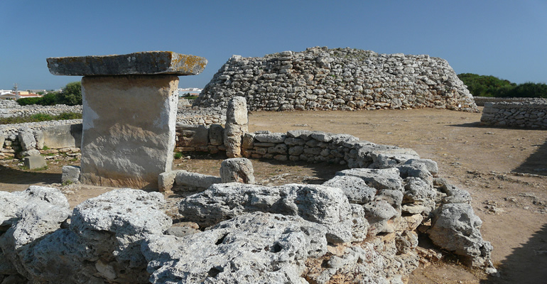
- The prehistoric settlement of Trepucó extends over 5,000 m2 and was originally walled. To the south you will see two Talayots (megaliths): the first is more spectacular due to its large dimensions, a circular floor plan with a star shape in the centre of the fortification. The second, smaller construction is built into the perimeter wall to the north east of the settlement.
In the south is a centre of worship with the biggest “taula” (altar) on the island. You can admire five Talayotic houses of different types.